
Dr. Ahmed Abdalla
 |
| In front of the Harbour Bridge, 2010. Sydney, Australia |
Contact
Email : ahmed.abdalla[a]uofk.edu
ahmed.abdalla[a]live.se
Assistant Professor
Dept. of Surveying Engineering
University of Khartoum
Omdurman, Sudan
Lecturer
Dept. of Surveying Engineering
University of Khartoum
Khartoum, Sudan
Find me in the following links
My Google Scholar Profile
My ResearchGate Profile
Linkedin
Formerly at:
National School of Surveying
University of Otago
310 Castle Street
Dunedin, 9016
New Zealand
Phone: +64 3 479 5240
Mobile: +64 226 003 753
Fax : +64 3 479 7586
Education history
- PhD in Geodesy from University of Otago, Dunedin, New Zealand, in 2013. Thesis title “The Combined Modelling of the Regional Quasigeoid of New Zealand Using Gravity and GPS/levelling data“. Under supervision of Professor Robert Tenzer.
- MSc. in Geodesy and Geoinformatics from Royal Institute of Technology (KTH), Stockholm, Sweden, in 2009. Thesis title “Determination of a Gravimetric Geoid Model of Sudan Using the KTH Method“. Under supervision of Dr. Huaan Fan, Examiner Professor Lars Sjöberg.
- BSc in Surveying Engineering from University of Khartoum, Khartoum, Sudan, in 2003. Thesis title “Establishment of a Traverse Around the Southern Part of the University of Khartoum Campus Using Total Station and Theodolite“. Under supervision of Dr. Mohamed Osman Adam.
Academic Career
- (Jan 15 -update) Teaching Least Developed Regions Program – Western Sudan
- (2014-update) at Omdurman Islamic University
- Error and Adjustment (SE322)
- Physical Geodesy (SE424)
- Teaching the following courses (2014-2015) at University of Khartoum
- Geometrical Geodesy 1 (SE411)
- Geometrical Geodesy 2 (SE421)
- Teaching assistant for land surveying course at Unitec Institute of Technology, Auckland, New Zealand (Aug 2013 t0 Nov 2013)
- Worked as a teaching assistant (during my PhD) of the following courses :
- Surveying Mathematics (Surv202) : 2011 and 2012
- Surveying Methods 2 (Surv301): 2012
- Surveying Methods 3 (Surv451): 2011 and 2012
Supervisions
Undergrad Theses (2014-2015)
- Mohtadi Mohamed (University of Khartoum)
- Mohamed Elfadil (University of Khartoum)
- Bushra Jamaleldin (University of Khartoum)
- Mosaab Omer (University of Khartoum)
- Mohamed Abdelrahman (University of Khartoum)
- Mohamed Samual (University of Khartoum)
- Mohamed Elmustafa (University of Khartoum)
- Mohamed Sami (University of Khartoum)
- Abdelrashid Taha (University of Khartoum)
Awards
- The University of Otago Research Bursary for postgraduate students 2013, New Zealand.
- NZ Geoscience Travel Grant 2012, Hamilton -New Zealand.
- NZ Geoscience Travel Grant 2011, Nelson -New Zealand.
- International Union of Geodesy and Geophysics (IUGG) Student Grant June 28 to Jul 7, 2011, Melbourne, Australia.
- NZ Geoscience Travel Grant 2010, Auckland- New Zealand.
- University of Otago Postgraduate Scholarship, New Zealand. Jan, 2010-Dec, 2012.
- School of Surveying Postgraduate Scholarship – University of Otago, New Zealand. Nov to Dec, 2009.
- Sudanese Engineering Society prize for best academic performance in graduation project (Thesis) at Department of Surveying Engineering, University of Khartoum (2002-2003), Sudan
Professional Career
- Surveyor at John Fillmore Contractors (JFC), Aukland, New Zealand
- Surveyor at Elnefeidi Group, Khartoum, Sudan, from 2003 to 2008
Memberships
- A steering committee member of the Sudanese Geoinformatics Society (SGS) – Since 2014 (under establishment)
- Member of Sudanese Engineering Council, Sudan
- African Gravity and Geoid Regional Sub-commission 2.4d – International Association of Geodesy (IAG) – Steering committee full member.
- Associate Editor of Journal of Geodetic Science , Versita
- Editorial board member at Global Journal of Earth Science and Engineering
Reviewing Experience (2011- to date)
- Journal of Earth Science Informatics, Springer
- Acta geodaetica et Geophysica Hungarica, Springer
- KSCE Journal of Civil Engineering, Springer
- Journal of Applied Geomatics, Springer
- Journal of Computer and Geosciences, Elsevier
- Journal of Applied Geophysics, Elsevier
- Journal of African Earth Sciences, Elsevier
- Global Perspectives on Geography (GPG), American Society of Science and Engineering
Textbooks
- Abdalla A, (2015) Error and Adjustment, Lecture notes for 3rd year students, Dept. of Surveying Engineering, Omdurman Islamic University, Sudan (in progress)
- Abdalla A, (2015) Physical Geodesy, Lecture notes for 4th year students, Dept. of Surveying Engineering, Omdurman Islamic University, Sudan (in progress)
- Abdalla A, (2014) Geometrical Geodesy, Lecture notes for 4th year students, Department of Surveying Engineering, University of Khartoum, Khartoum, Sudan.
- Abdalla A and Denys P., (2011) Matlab Tutorials in Surveying Mathematics, Tutorials for 2nd year students, School of Surveying, University of Otago, Dunedin, New Zealand.
Conference presentations
- Abdalla A, Tenzer R (2012) Improved gravimetric solution for the height reference surface in New Zealand. The Geosciences 2012, The annual conference of the Geoscience Society of New Zealand, 25-28 November, 2012, Hamilton, New Zealand (poster presentation)
- Abdalla A, Tenzer R (2012) Accuracy assessment of the global and regional gravimetric geoid/quasigeoid. The Geosciences 2011, The annual conference of the Geoscience Society of New Zealand, 25-28 November, 2012, Hamilton, New Zealand (poster presentation)
- Tenzer R, Abdalla A, Novák P (2012) New experimental quasigeoid model for New Zealand – OTG12. Session 4: Advances in Precise Local and Regional High‐Resolution Geoid Modeling, International Symposium on Gravity, Geoid and Height Systems GGHS 2012, October 9-12, 2012, Venice, Italy (poster presentation)
- Abdalla A, Tenzer R, Gan L (2011) Towards improvement of the vertical reference system in New Zealand using GPS, levelling, gravity and altimetry data. The Geosciences 2011, The annual conference of the Geoscience Society of New Zealand, 27 November – 1 December, 2011, Nelson, New Zealand (oral presentation)
- Abdalla A, Tenzer R (2011) New approach for the gravimetric quasigeoid modelling using Green’s discretized integral equations and Molodensky’s types of expressions. The Geosciences 2011, The annual conference of the Geoscience Society of New Zealand, 27 November – 1 December, 2011, Nelson, New Zealand (poster presentation)
- Tenzer R, Abdalla A, Vatrt V, Dayoub N (2010) Average offsets of the local vertical datums in New Zealand relative to the World Height System. Session MPRG5/G17: From large to small scales for potential fields – tools and models European Geosciences Union (EGU) General Assembly 2010, May 2-7, 2010, Vienna, Austria (poster presentation)
- Tenzer R, Abdalla A, Novák P (2010) Global maps of the ellipsoidal corrections to gravity disturbances and gravity anomalies computed using the EGM2008 global geopotential model. Session MPRG5/G17: From large to small scales for potential fields – tools and models European Geosciences Union (EGU) General Assembly 2010, May 2-7, 2010, Vienna, Austria (poster presentation)
- Mikuška J, Marušiak I, Tenzer R, Abdalla A (2010) The topographic gravity correction computed based on the 2-D digital rock density model of New Zealand. GeoNZ2010 conference of Geoscience Society of New Zealand and New Zealand Geothermal Workshop, Symposium 21: New frontiers and general geosciences, November 22-24, 2010, Auckland, New Zealand (poster presentation).
- Čunderlík R, Tenzer R, Abdalla A (2010) The dynamic surface topography offshore New Zealand derived from the DNSC08 mean sea surface and the BEM marine geoid (preliminary study). Active Earth Processes Workshop 2010, Otago University, Dunedin, 18 November 2010 (poster presentation).
- Abdalla A, Tenzer R, Čunderlík R (2010) A comparison of the currently available global and regional geoid/quasigeoid models in New Zealand. Active Earth Processes Workshop 2010, Otago University, Dunedin, 18 November 2010 (poster presentation).
- Čunderlík R, Tenzer R, Abdalla A (2010) Gravimetric quasigeoid modelling using the boundary element method (a case study for New Zealand). Active Earth Processes Workshop 2010, Otago University, Dunedin, 18 November 2010 (poster presentation).
- Gregory K, Tenzer R, Denys P, Hannah J, Abdalla A (2010) Decoupling the glacial isostatic adjustment and vertical tectonic motions from GPS time series and ICE-5G data (case study for New Zealand). Active Earth Processes Workshop 2010, Otago University, Dunedin, 18 November 2010 (poster presentation).
- Tenzer R, Novák P, Abdalla A, Vajda P, Ellmann A (2011) A spectral modelling of the gravitational contribution of the far-zone topography. Session G1.1: Geodetic Theory – Recent Developments in Geodetic Theory, April 3-8, 2011, Vienna, Austria (poster presentation).
- Tenzer R, Abdalla A, Čunderlík R (2011) Comparison of the dynamic sea surface topography with the ocean currents in the Southwest Pacific Ocean and Tasman Sea. Session OS1.1: Ocean General Circulation and Climate – Open session on ocean circulation, April 3-8, 2011, Vienna, Austria (poster presentation).
Research seminars
- Abdalla A (2015) Contribution of Modern Geodesy in Earth Sciences and Engineering. Surveying Engineering Students Association, Engineer’s Week 16, University of Khartoum, Khartoum, Sudan, 23rd April 2015 (oral presentation).
- Abdalla A (2015) Space Technologies (Anticipated uses!). Sudanese Geoinformatics Society (SGS), First Scientific meeting, Future Universiy, Khartoum, Sudan, 31st January 2015 (oral presentation).
- Abdalla A (2013) The role of modern geodesy in academia and Society. Division of Geomatics, Universiy of Cape Town, Cape Town, South Africa, 15th February 2013 (oral presentation).
- Tenzer R, Abdalla A (2012) Gravimetric quasigeoid modeling using the discretized integral-equation approach. School of Geodesy and Geomatics, Wuhan University, Wuhan, China, 30 November 2012 (oral presentation).
- Abdalla A, Tenzer R , (2012) New experimental regional model of New Zealand (OTG12), Surveying Research Workshop, School of Surveying, Otago University, Dunedin, New Zealand, 2nd of August, 2012 (oral presentation).
- Rýznarová L ,Tenzer R , Abdalla A, Wiart A (2012) Regional validation of GRACE monthly solutions using oceanographic datasets, Surveying Research Workshop, School of Surveying, Otago University, Dunedin, New Zealand, 2nd of August, 2012 (oral presentation).
- Abdalla A, (2011) Accuracy analysis of state-of-the-art global gravity models using GPS-levelling and gravity data – a New Zealand case study, Surveying research seminar series, School of Surveying, Otago University, Dunedin, New Zealand, 18th of August, 2011 (oral presentation).
- Tenzer R, Gan L, Čunderlík R, Abdalla A (2011) On some problems with the realization of the World Height System in New Zealand. Institute of Geodesy and Photogrammetry, Malaysia University of Technology, Skudai, Johor, Malaysia, 1st of April 2011 (invited oral presentation).
- Abdalla A, Tenzer R (2010) A compilation of the new geoid model in New Zealand using the KTH method. Active Earth Processes Workshop 2010, Otago University, Dunedin, 18 November 2010 (oral presentation).
- Abdalla A, Tenzer R (2010) First results of a new gravimetric geoid model for New Zealand. Surveying research seminar series, School of Surveying, Otago University, Dunedin, New Zealand, 12th of February, 2010 (oral presentation).
- Tenzer R, Abdalla A (2010) Comparison of the new gravimetric geoid model KTH-NZ2010.v1 with existing quasigeoid models for New Zealand. Surveying research seminar series, School of Surveying, Otago University, Dunedin, New Zealand, 12th of February, 2010 (oral presentation).
Conference proceedings
- Abdalla A., Anwar, A., Jaafar, M. Elmontasir, M and Eltayeb, Y., Multi-station baseline calibration of errors induced by phase inhomogeneity in electronic distance measurement devices (in progress)
- Abdalla A., Elmahal, A., Utilisation of Gaussian filter in augmentation of vertical accuracy of digital elevation models with respect to levelling data (in progress)
- Abdalla A., Tenzer, R., (2012) The integral-equation-based approaches for modelling the local gravity field in the remove-restore scheme, International Association of Geodesy Symposia
- Tenzer, R., Abdalla A.,Gan, L (2012) The differences between the normal, orthometric and normal orthometric heights in New Zealand, International Association of Geodesy Symposia
- Tenzer, R., Abdalla A., Gan, L (2012) Joint adjustment of the levelling networks in New Zealand using levelling, tide-gauge, and EGM08 gravity data, International Association of Geodesy Symposia
Peer-reviewed papers
- Abdalla, A., et., al. (2014) A 2-dimentional adjustment of geodetic metwork measurements using least-squares methods (in preparation)
- Abdalla, A. (2014) Comparison of different interpolation methods for evaluating and gridding terrestrial gravity data for the sake of geoid determination (in preparation)
- Abdalla, A. (2014) Temporal variations of the Earth gravity field and gravimertic geoid model captured by time series of GRACE monthly data (In progress)
- Abdalla, A. (2014) Contribution of linear convolution filters, GOCE geopotential models and residual terrain model in refining the gravity anomaly data grid: A proactive strategy (In progress)
- Abdalla, A. (2014) Inter-comparisons of global digital elevation models and levelling data for vertical accuracy assessment of the orthometric heights. (In progress)
- Abdalla, A. (2014) Cross Validation for gross error detection of terrestrial gravity data. (Under review)
- Abdalla, A., Mogren, S. (2014) Implementation of a rigorous least-squares modification of Stokes formula to compute a precise geoid model over Saudi Arabia (SAGEO13). (Accepted)
- Abdalla, A. (2014) Effect of Linear Gaussian filter on geoid height determination: A comparison study over Sudan and New Zealand. (Under review)
- Abdalla, A. (2014) Infuence of Linear Convolution filters on gravity data smoothing and noise ellimination (Submitted)
- Abdalla, A. (2014) The use of discretised integral equations to compute gravimetric geoid-quasigeoid models: A comparison between Stokes integral and Green integral equations. (Under review)
- Abdalla, A.(2014) The utilisation of Fast Fourier Transform and Least-squares Modification of Stokes formula to compile an approximate geoid model over Khartoum State: Sudan (Under review)
- Abdalla, A., Tenzer, R. (2013) Effect of reference field and topography corrections on the accuracy of New Zealand quasigeoid model using Green’s integral approach (Under review) Journal of Applied Geomatics.
- Abdalla, A., Tenzer, R (2012) Compilation of the regional quasigeoid model for New Zealand using the discretized integral-equation approach. Journal of Geodetic Science.
- Abdalla, A., Fashir, H.H., Ali, A., Fairhead, D., (2012) Validation of Recent GOCE/GRACE Geopotential Models Over Khartoum State – Sudan , Journal of Geodetic Sciences, DOI: 10.2478/v10156-011-0035-6.
- Tenzer, R., Dayoub, N. and Abdalla, A. (2012) Analysis of a relative offset between vertical datums at the North and South Islands of New Zealand Journal of Applied Geomatics.
- Abdalla, A., Tenzer, R., (2012) The global geopotential and regional gravimetric geoid/quasigeoid models testing using the newly adjusted levelling dataset for New Zealand Applied Geomatics, DOI:10.1007/s12518-012-0089-x.
- Tenzer, R., Čunderlík, R., Dayoub, N. and Abdalla, A. (2011) Application of the BEM approach for a determination of the regional marine geoid model and the mean dynamic topography in the Southwest Pacific Ocean and Tasman Sea., Journal of Geodetic Science, DOI: 10.2478/v10156-011-0019-6.
- Tenzer R, Vatrt V, Luzi G, Abdalla A, Dayoub N (2011) Combined approach for the unification of levelling networks in New Zealand. Journal of Geodetic Sciences.
- Abdalla A, Fairhead D (2011) A new Geoid model for Sudan using the KTH method. J of African Earth Sciences, DOI:10.1016/j.jafrearsci.2011.02.012.
- Abdalla A, Tenzer R (2010) The evaluation of the New Zealand’s geoid model using the KTH method. Journal of Geodesy and Cartography. doi:10:3846/13921341-2011-558326.
- Tenzer R, Novák P, Vajda P, Ellmann A, Abdalla A (2011) Far-zone gravity field contributions corrected for the effect of topography by means of Molodensky’s truncation coefficients. Studia Geophysica et Geodaetica, DOI:10.1007/s11200-011-0004-7.
- Tenzer R, Abdalla A, Vajda P, Hamayun (2010) The spherical harmonic representation of the gravitational field quantities generated by the ice density contrast. Contributions to Geophysics and Geodesy, 40(3): 207-223, DOI:10.2478/v10126-010-0009-1.
- Čunderlík R, Tenzer R, Abdalla A , Mikula K (2010) The quasigeoid modelling in New Zealand using the boundary element method. Contributions to Geophysics and Geodesy, DOI:10.2478/v10126-010-0011-7.
- Tenzer R, Vatrt V, Abdalla A, Dayoub N (2010) Assessment of the LVD offsets for the normal-orthometric heights and different permanent tide systems. Applied Geomatics, DOI:10.1007/s12518-010-0038-5.
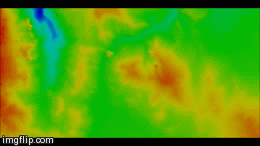 |
| Effects of filtering on several DEMs over Khartoum area |
Countries I stuck around, visited or stopped over
#counter_178836 {font-family: “Verdana”; font-size: 11px; clear: left; color: #BBBBBB;} #counter_178836 a {color: #BBBBBB;}#counter_div_178836 {height: 15px}
Create your own travel mapAhmed has traveled to: Australia, Bahrain, Belgium, Denmark, Egypt, Estonia, Ethiopia, France, Germany, Hong Kong, Netherlands, New Zealand, Norway, Saudi Arabia, Sudan, Sweden, Turkey, United Arab Emirates, United States, USA States: Maryland, New Jersey, New York, Pennsylvania
Leave a Reply